OF CAMPO VALLEY HYDROLOGY • [Based on an interview with
Arvilla's family has been in the Campo valley since 1875. Their last name was Clark.
They homesteaded here, and built a house on a knoll in the middle of the valley, the remains of which
still exist to this date.
The Clarks, Chilwells and Campbells (originally from England) have ranched here, off and on, since that time.
They grazed cattle down in Mexico, and would bring the cattle back, using the Mount Laguna and Cuyamaca areas.
Archie Chilwell became the manager of the Campo Cattle Company, one of the largest cattle operations in the area.
In 1929, he had a trainload of cattle heading east
for sale, and every time they would stop, they would check the price of cattle, and it kept getting lower and lower.
They basically went bust; that was the end of the Campo Cattle Company.
Archie Chilwell went to Arizona and worked on the ranches on the Indian reservations.
That is when Arvilla's grandmother decided to move to Campo. Her father, who was a civil engineer with the city of San Diego,
decided to quit that business and moved to Campo and started ranching.
Arvilla's father leased about 3000 acres, running cattle from the Mexican border up to Mount Laguna.
He used the Campo field as winter pasture and feedlots. Eventually, he got out of the cattle business because of the drought.
The drought started in the 1940s and proceeded to get worse.
By 1958, he was getting into chickens and turkeys.
Arvilla and I were married in 1959. We eventually moved to Arizona, stayed there for about 37 years,
and came back to retire here. We are trying to keep the ranch in the family. It is not a large piece; about 100 acres.
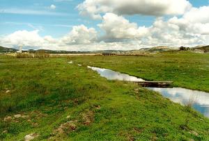
We have a Mediterranean ecosystem, with a geologic control downstream of the valley.
There is a lot of alluvial material, and the groundwater is reasonably high at the lower end of the valley.
Further up the valley, the water table is further down. We have a lot of granite outcroppings.
Rainfall averages about 15 in per year; toward Mount Laguna and Lake Morena it is more abundant.
The county figures that it takes 8 acres for one dwelling unit. Some people drill wells to 1000 ft to get
2 or 3 gallons per minute; others get 200-300 gallons, but this is unusual.
Most get 10-20 gallons. Water is a critical resource; everything
is groundwater-dependent. It is not likely that we will have any water shipped in.
The drought cycle seems to be about 11 years.
The rain gage near the Campo Stone Store washed away in 1891; it sustained 11 inches in about 100 minutes, a record
rainfall intensity in California.
We have a write-up from Arvilla's great-grandfather Campbell, who was a witness to the event.
The gage that we now have is similar in design.
The weather station here came about because Arvilla's father found that the weather station
in Mount Laguna was not reliable, and not manned often.
Arvilla's mother manned the gage for about 40 years, from 1950 to 1991.
Arvilla's father built the Campo berms to keep the erosion down and retain the water.
He did it back in the 1940s and 1950s. Later, there was a long dry spell. The rain of the 1980s washed them out,
so he put some back in. Downstream there is a brick abutment, by the Stone Store,
that builds up a dam. He noticed some erosion and helped dam it up, so that the headcut would not propagate back into the valley.
There are several small dams across the valley.
In the middle of the valley, the water level today is right at the surface. But, 200 ft away from the
edge of the valley, in the direction of the surrounding hills, the situation is quite different.
A local school has drilled a well, and did not find water until they reached a depth of 800 ft.
Population has been increasing since the 1970s.
Arvilla's father used to pump a lot of water for surface irrigation, because the water table had dropped so much that the grass would
not grow in the summer time. He flood-irrigated the fields when the water table in the valley
was down to about 27 feet. When the rains returned,
the water table came back up.
I have heard from Arvilla's father, who was raised here, that at one time
Campo Creek flowed year-round; that would mean that
the aquifer was full.
A 5-yr moving average of precipitation reveals a decreasing trend of precipitation in
Campo valley. A combination of things may have led to the dry out:
the grazing, the droughts, the floods that created the gullies, the pumping,
the people putting their wells down, and the changing weather patterns.
Around the 1940s, the mean annual rainfall started decreasing, from 20 in to about 15 in.
|
| 050721 |