Satellite image of South Florida
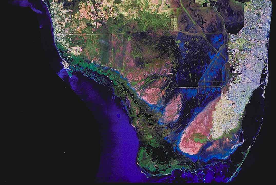
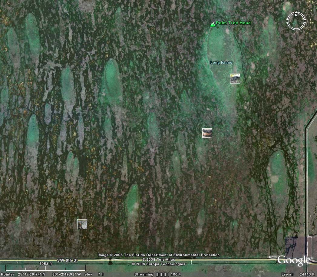
Satellite image of South Florida.
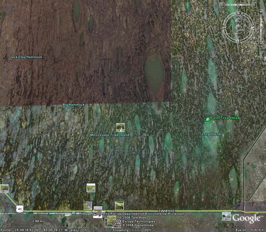
Note the alignment of the hummocks, parallel to the flow patterns of the Everglades swamp, as it makes its way to the tip of Southern Florida.


Satellite image of Water Conservation Area 3,Everglades, South Florida
Satellite image of Water Conservation Area 3,
Everglades, South Florida.


Vegetation map of Water Conservation Area 3,<br>Everglades, South Florida (1/8 scale)
Vegetation map of Water Conservation Area 3,
Everglades, South Florida (1/8 scale)


Aerial view of hummocks, Everglades, South Florida
Aerial view of hummocks, Everglades, South Florida.


Close view of hummocks, Everglades, South Florida.


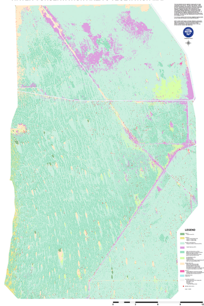
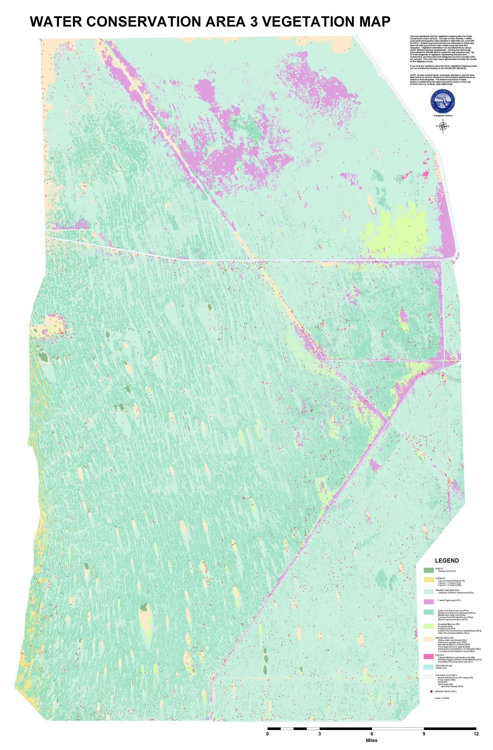
Vegetation map of Water Conservation Area 3, Everglades, South Florida (1/4 scale)


Vegetation map of Water Conservation Area 3, Everglades, South Florida (1/2 scale)


Vegetation map of Water Conservation Area 3, Everglades, South Florida (full scale)