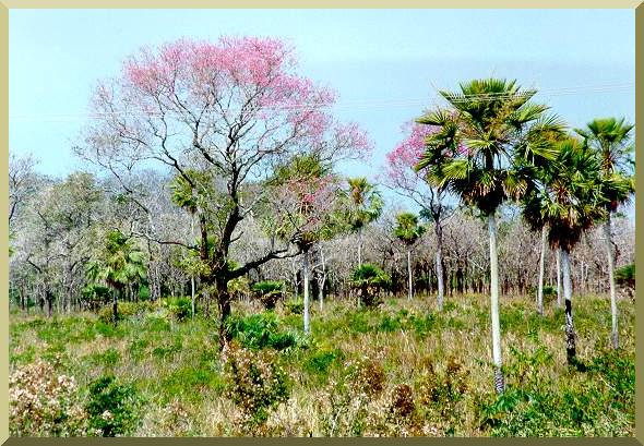
| The Pantanal of Miranda-Aquidauana, Mato Grosso do Sul. |
HYDROLOGIC AND ENVIRONMENTAL IMPACT
| The Pantanal of Miranda-Aquidauana, Mato Grosso do Sul. |
|
This section evaluates the hydrologic impact of the Hidrovia project on the Pantanal of Mato Grosso, that is, the changes in water and sediment runoff to be expected as a result of project implementation. An analysis of possible downstream impacts and other related environmental impacts is included in this section. The evaluation is divided into four parts:
This section analyzes, interprets, and expands on the previous sections. The reference sources are listed in Appendix 1. The figures and tables are included in Appendices 2 and 3, respectively.
4.1 Runoff ImpactsThe runoff impacts of the Hidrovia project on the Upper Paraguay river and the Pantanal of Mato Grosso can be considered under four categories:
Normally, the effects of natural or human-induced changes in runoff patterns are subject to evaluation using mathematical (i.e., computer) modeling. While computer modeling is routine practice in small and midsize basins, it is a complex undertaking--and often a logistical nightmare--in very large basins, particularly those located in remote and inaccessible regions. The Upper Paraguay river basin, with its 496 000 km2 (of which 145 000 km2 located in Bolivian and Paraguayan territory are largely without data), does not lend itself readily to mathematical modeling. This is due to its unusual spatial complexity, which includes high channel sinuosity, numerous bifurcations, seasonal over flows, and endorheic and often confusing drainages. In addition, there is a seasonal abundance of aquatic macrophytes in the surface waters, and an active--and for all practical purposes, intractable--interaction between surface water and groundwater. The modeling carried out in the early 1970's by DNOS, with the technical assistance of UNDP/UNESCO, proved to be a challenge (DNOS, 1974). The SSARR model (Streamflow Synthesis And Reservoir Regulation), developed by the North Pacific Division of the U.S. Army Corps of Engineers was used to model the response of the Upper Paraguay river basin to distributed precipitation inputs (U.S. Army Engineer North Pacific Division, 1975). The objective was to develop a flood forecasting capability so that sufficient warning could be given in the event of an extraordinary or exceptional flood. With a limited budget, the model continues to be operated to this date (1995) by the Companhia de Pesquisa de Recursos Minerais, in Rio de Janeiro. In light of the unusual complexity of the Upper Paraguay river system and adjoining Pantanal, the predictive capability of the model often falls short of expectations. The difficulty appears to be the inability of the model to adjust its parameters in real time to account for the variability of the flow (inbank, overbank, and high overbank). SSARR is a conceptual runoff model based on the cascade of linear reservoirs, while the Upper Paraguay river and adjoining Pantanal have marked two- and three-dimensional flow patterns, in addition to strong nonlinear interactions between inbank and overbank flows (Ponce, 1989). These nonlinear interactions results in the flood peak typically being accelerated during exceptional and extraordinary floods, slowed down during common and mean floods, and again accelerated during drought years (Section 4.1.1) (PORTOBRAS, 1983). To compound its spatial diversity, the Upper Paraguay river is constantly changing its bed to adjust to changes in water and sediment discharge. Furthermore, the river is subject to geologic controls (rock outcrops and abutting rocky hills) that condition the development of its gradient in the geologic time scale. No currently available mathematical model is effectively able to account for all these features and their variabilities. This study will use analysis based on established principles of hydrology and river hydraulics to evaluate the hydrologic impact of the Hidrovia on the Pantanal of Mato Grosso.
4.1.1 Changes in Flood RegimeThe question is whether the proposed navigation improvements on the Upper Paraguay river will change the river's flood regime and affect the Pantanal of Mato Grosso. The proposed navigational improvements include channel straightening by realignment and cutoffs, dredging, blasting of rocky sills and other rock out crops, and the possibility of hydraulic control structures (IDB, 1995). These interventions are likely to have a substantial impact on the flood regime, the degree of which will vary depending on the type and extent of intervention, and its location along the river. In order to evaluate the impact, the needs of the Hidrovia are contrasted here with the nature of the river. The Hidrovia needs a channel sufficiently straight, wide, and deep:
While the dimensions of the proposed navigation channel have yet to be determined, a 50-m wide, 3-m deep channel has been initially considered (CEBRAC/ICV/WWF, 1994). Whether the 3-m depth requirement will be demanded all the way to Cáceres, the furthest upstream point of the Hidrovia, is still under study. In contrast with the first requirement of the Hidrovia, the river traces a sinuous or meandering path. (Sinuosity is defined as the ratio of river length to valley length). The sinuosity of the Upper Paraguay river varies widely, from 2.93 from 40 km downstream of Porto Conceiçăo to Refúgio das Tręs Bocas, to 1.17 from Corumbá to the confluence with the Taquari Velho (Table 1). Within individual reaches, the highest sinuosity is in the vicinity of Porto Conceiçăo, where the ends of a 50-km reach are separated by a straight distance of only 13 km, i.e., a sinuosity of 3.85 (INTERNAVE, 1990). Particularly upstream of Corumbá, where the river is more sinuous, channel straightening is likely to bring about substantial changes in the flood regime. The effect of channel straightening on flood runoff is evaluated by examining the flood peak at Ladario, close to the center of the Pantanal (Fig. 3). Figure 8 shows a plot of peak flood stage vs date of occurrence at Ladario. The median peak flood stage for the entire period of record (1900-95) is 4.45 m. Examination of Fig. 8 leads to the following conclusions:
As shown in Table 13 and Fig. 8, in the past 22 years (1974-95) the median peak flood stage for the entire period of record has been exceeded 19 times, i.e., 86 percent of the time! The implication of this fact is that some extraordinary floods may be downgraded to mean floods, possibly due to changes in hydrologic response which may already be occurring in the basin (Section 4.1.4). Thus, it is concluded that during high mean floods (2-yr), extraordinary (4-yr) and exceptional (10-yr) floods, channel straightening will accelerate the concentration of flood runoff and increase the flood wave peak. The sinuosity reflects the river's tendency to meander, a natural process which is conditioned by its water and sediment discharge, channel slope, and boundary friction (bed and bank friction). A decrease in sinuosity as a result of channel straightening increases channel slope, leads to changes in water and sediment discharge, and triggers morphological channel adjustments in search of a new equilibrium. Due to spatial heterogeneity, in many instances these adjustments are difficult to evaluate a priori. However, it is known that sinuosity is directly related to channel stability; therefore, a reduction in sinuosity is likely to decrease channel stability (Blench, 1986). In contrast with the second requirement of the Hidrovia, the river provides its own width and depth, a function of its water and sediment discharge, channel slope, boundary friction, and degree of geologic control. Table 1 shows that the inbank top width of the Upper Paraguay river varies from 120 m from Boca do Bracinho to Barra do Bracinho, to 600 m from Barra do Nabileque to the Apa river confluence. Table 19, Column 3, shows measured minimum average flow depths, which vary from 1.25 m at Cáceres to 8.83 m at Porto Murtinho. (The average flow depth of a river cross section is defined as the flow area divided by the top width, Chow, 1959). These are measured minimum average flow depths (taken across the river's width), and not seasonal minimum flow depths in the deepest section of the channel, as would be required for navigation. On the basis of Table 19, it is concluded that the Upper Paraguay river upstream of Porto Săo Francisco is incapable, without extensive artificial channel deepening, of accomodating ocean-going vessels (with a 3-m draft requirement) throughout the year. Table 19 shows that downstream of Porto Săo Francisco, the river is sufficiently deep even during low-flow periods. Since Porto Săo Francisco is very small, and located only 146 km upstream of the major commercial port of Corumbá/Ladario, the latter is usually considered as the destination point of upstream-bound traffic. Current barge traffic from Corumbá downstream, towards Asunción and Buenos Aires is at least two orders of magnitude greater than the traffic from Corumbá upstream, towards Cáceres. According to A Gazeta of Cuiabá, of February 21, 1995, only two boats with 5000 tons of soy left the port of Cáceres toward Corumbá in 1994 (International Rivers Network, 1995). Thus, the Hidrovia appears to be feasible up to Corumbá without major modifications to the natural channel. However, the extension of a 3-m navigation channel all the way to Cáceres will require major interventions in the natural channel. Aside from the measured minimum average flow depths shown in Table 19, seasonal minimum flow depths in the navigation channel can be less than 3 m on several locations along the Upper Paraguay river, from Porto Murtinho to Cáceres. These locations are referred to as passos in Portuguese (a shallow or pass in English), and identified as such in navigation charts (Marinha do Brasil, 1974). Table 20 lists the 54 passes identified along the Upper Paraguay river. It is seen that 40 percent of these passes (22 out of 54) are concentrated in the most upstream reach, Descalvados-Cáceres, where navigation is difficult at best. The INTERNAVE (1990) report has noted that the minimum flow depth in the passes located between Descalvados and Cáceres ranges from 0.2 m to 1.5 m in dry years. Moreover, the Japuira pass, in the Porto Conceiçăo-Descalvados reach, appears to be extremely shallow, with minimum flow depth of only 0.1 m during dry years. The bottom (bed) of the Upper Paraguay river is predominantly sandy, but with significant rock outcrops throughout its length (See Table 8). Observations of stage-discharge relations have confirmed the so-called autodredging phenomenon, by which the river seeks to maintain a minimum depth during seasonal low flows (PORTOBRAS, 1983; INTERNAVE, 1990). This autodredging mechanism functions only as long as the river is able to move its bed freely. Apparently, by adjusting the shape and configuration of its bedforms, the river is able during low flows to reduce its discharge while maintaining an approximately constant stage (and a minimum flow depth). In the Upper Paraguay river, this minimum depth is 1.2 m, except where rock outcrops do not permit autodredging to take place (PORTOBRAS, 1983). Thus, if it were not for the rocky sills, the river would produce a minimum depth of 1.2 m through out its length. To the extent that this minimum depth is violated in many places along the river, it is concluded that the slope of the Upper Paraguay river is geologically controlled. The Hidrovia project includes channel straightening, dredging, and blasting of rocky sills (IDB, 1995). Each of these interventions is discussed here separately.
Channel Straightening
Channel straightening shorthens the path of runoff, decreases the time of
concentration, accelerates runoff concentration, and leads to increases in flood peaks.
This type of intervention in the natural channel is being considered upstream of Amolar, where the
river is more sinuous. For instance, the Internave report has proposed shortening by 62
km the distance between Cáceres (km 3442) and Ponta do Morro (km 3030)
(INTERNAVE, 1990). Without the necessary details, it is difficult to evaluate the
hydraulic effect of this significant intervention in the river.
Nevertheless, some approximations are
possible at this time. From Table 12, the average channel slope from Cáceres to Bela Vista
do Norte (km 3047), 17 km upstream of Ponta do Morro (Fig. 7), is:
(110.09 m - 89.80 m) (100 cm/m) /(3442 km - 3047 km) = 5.14 cm/km
which would increase to
(110.09 m - 89.80 m) (100 cm/m) /(3442 km - 3047 km - 62 km) = 6.09 cm/km with the implementation of the proposed channel straightening. Based on the Manning equation (Chow, 1959), and assuming for simplicity average flow conditions and a rigid boundary, this increase in channel slope represents an increase of 5 percent in mean velocity and a decrease of 5 percent in flow depth. The effect of channel slope changes is also subject to evaluation using the well known Lane relationship, which states that the product of water discharge and channel slope is proportional to the product of sediment discharge and particle size, as follows (Lane, 1955): Qw S ∝ QS d (Eq. 4.1) in which Qw = (water) discharge, S = channel slope, Qs = sediment discharge (taken as the sum of bed load plus suspended bed material load, excluding wash load), and d = particle size diameter. Since sediment concentration is Cs = Qs / Qw (Eq. 4.2) it follows that for a given particle size (constant d) Cs (proportional to) S (Eq. 4.3) i.e., an increase in channel slope will cause a proportional increase in sediment concentration. In this case, Cs-final / Cs-initial = 6.09 / 5.14 = 1.18 (Eq. 4.4) Thus, the proposed channel realignment is likely to cause an increase of close to 20 percent in the concentration and transport of bed material sediment.
DredgingDredging increases the cross-sectional area of the channel, albeit temporarily. This increases channel conveyance and the channel's ability to transport runoff (Chow, 1959). The hydraulic effects of dredging are difficult to evaluate directly, since the river reacts to dredging by adjusting its bed material load (suspended load and bed load) to eventually reach a new equilibrium. According to Jansen et al (1982), in the long term, there will be upstream degradation, i.e., a lowering of the channel bed which will lower the groundwater level in the vicinity, resulting in a decrease in baseflow.
Blasting of Rocky SillsBlasting rocky sills as a means of deepening the navigation channel will have an irreversible impact on the hydrology of the Upper Paraguay river. This is the the most significant planned intervention; if pursued, it is likely to change the Pantanal forever. Analysis of navigation charts show that, in general, the river has been able, through geologic time, to carve a sufficiently deep channel through most of the rock outcrops. For instance, in the vicinity of Amolar, at km 2958, where the river has partly eroded into the Serra do Amolar, the flow depth can reach values greater than 14 m, cutting mostly through rock. Likewise, a short distance downstream, at Morro Dourados (km 2956), the flow depth on the right bank, abutting with the adjacent hill, is greater than 22 m! (Marinha do Brasil, 1974). Yet, in other places, where rocky sills protrude into the channel, the depth is shallower because the river has not yet carved an opening through these rocks. The Pantanal exists because of these rock outcrops, which influence the regional flow patterns in at least three places: Amolar, Porto da Manga, and Fecho dos Morros (Section 3.3.1). In particular, the hump at Amolar, together with a possible geologic control in the vicinity of the exit of Lagoa Gaíba, are instrumental in the creation of the Pantanal of Paiaguás, an important region of biological species diversity (Fig. 4). The extent to which bed profile convexities (humps) can cause backwater in the Upper Paraguay river can be estimated using principles of open-channel hydraulics (Chow, 1959). Table 21 summarizes water surface profile computations for Amolar and Porto da Manga, where significant humps have been identified (Section 3.3.1). A hypothetical prismatic channel is assumed for simplicity. The hump at Amolar (47 cm) is shown to increase the flow depth up to a distance of 339 km (99 percent of downstream depth increase), which could affect the stage as far upstream as Descalvados. Likewise, the hump at Porto da Manga (44 cm) increases the flow depth up to a distance of 417 km, which could affect the stage as far upstream as Bela Vista do Norte. These calculations confirm that relatively minor changes in grade, which would necessarily take place as a result of blasting rocky sills, can affect the upstream hydraulics to greater lengths than may have been anticipated. The great extent of the backwater profile is the reason why proposals for artificial control structures (e.g., dams, levees, and polders) in the Upper Paraguay river and Pantanal are usually controversial. Their permanent flooding of extensive adjoining areas which were either previously dry or only seasonally flooded can hardly be justified (Silva, 1990). For the same reason, proposals for the artificial removal of rocky sills, which act as natural dams, are also controversial. If implemented, they will dry out extensive areas which were normally subject to seasonal flooding. The point to emphasize with regard to the Pantanal is that any change will have wide-ranging spatial impacts. Besides being irreversible, the blasting of rock outcrops may prove to be unsustainable in the long run. The elimination of a rocky sill will cause upstream channel degradation until a new equilibrium bed, lower than the initial level, is attained (Jansen et, 1982). This will lower the groundwater level and reduce the baseflow. More importantly, however, the removal of one rocky sill may lead to the appearance of another rocky sill which was previously submerged (Jansen et al, 1982). This is a definite possibility in the Upper Paraguay river, which has a rock outcrop every 40 km on the average (Table 8), and where the prevailing channel slopes are so mild (1-2 cm/km) that the backwater effect of a 0.5-m flow obstruction may be felt for about 400 km upstream (Table 21). In summary, the following is concluded:
If implemented, these actions will have more serious impacts upstream of Corumbá/Ladario, particularly upstream of Porto Săo Francisco, where minimum flow depths are well below the proposed 3-m channel depth required for the navigation of ocean-going vessels.
4.1.2 Changes in BaseflowA well known principle of hydrology is that changes in flood regime produce changes in baseflow. This principle is predicated on the observation that the higher the flood peak, the lower the baseflow; conversely, the lower the flood peak, the higher the base flow. The rationale for this inverse relation is that a drop of rainfall that does not make it into the basin surface runoff is retained as basin wetting (Ponce and Shetty, 1995a), to follow one of two possible paths:
Thus, on the average, a drop of basin wetting has about a fifty percent chance of be coming baseflow. While the baseflow-wetting relations for the Upper Paraguay river remain to be established, a subhumid basin such as the Upper Paraguay does have a substantial baseflow component. It is noted that the minimum measured discharge at Porto Murtinho is 549 m3/s (Table 13). The well known sponge effect of the Pantanal on the Upper Paraguay river (Bucher et al, 1993) is partly accounted for by the conversion of the faster surface runoff into slower subsurface runoff. It follows that accelerating the concentration of flood runoff and increasing the flood peaks will produce a decrease in baseflow, which will lead to decreases in minimum flow depths, particularly in those locations where the self-dredging action is minimal or nonexistent. In the absence of more detailed studies, it is difficult to ascertain the extent of this decrease, but the tendency is there and should be acknowledged. Changes in baseflow regime (either losses or gains), although in smaller catchments, have been documented in the United States and other countries (for a recent review, see Ponce and Lindquist, 1990). Generally, a decrease in environmental moisture (i.e., less precipitation, less vaporization, and less total runoff) leads to baseflow losses, while an increase in environmental moisture (more precipitation, more vaporization, and more to tal runoff) leads to baseflow gains. The amount of baseflow is shown to be highly correlated with climatic regime. Loss of baseflow invariably leads to climatic changes in the direction of greater aridity. The issue of potential changes in baseflow is extremely relevant as far as the feasibility (and sustainability) of the Hidrovia project is concerned, since extensive channel modifications will lead to increases in high flows (flood peaks), which in turn will lead to de creases in low flows (which are mostly baseflow). Thus, it is expected that channel modifications (straightening, dredging, and blasting of rocky sills) will destabilize the river's baseflow regime. In turn, this will demand additional future action to continue to maintain the required minimum draft, i.e., it will set in place a vicious circle of channel interventions. This is an extremely serious issue, since it can potentially jeopardize the existence of the Pantanal.
4.1.3 Changes in Water YieldThe Upper Paraguay river has a mean flow of 1565 m3/s. This value was estimated at the Apa river confluence, based on existing measurements at Porto Murtinho and Fecho dos Morros (Table 12). Based on estimates of spatially averaged mean annual precipitation, a runoff coefficient of Kr = 0.08 (the ratio of runoff to rainfall) has been calculated (Section 3.3.4). How will this runoff coefficient be affected by the execution of the Hidrovia project? In the absence of detailed hydrologic analyses, experience with neighboring basins can provide useful guidelines as to the possible impacts. The relationship between the runoff coefficient Kr and the annual precipitation P is a characteristic of each basin, with dKr /dP being always positive, i.e., the runoff coefficient increases with annual precipitation (Ponce and Shetty, 1995b). This function is part of the basin's hydrologic signature, a characterization of its annual water yield or basin response to the given precipitation input. Changes in flood regime and baseflow (in creases in flood peaks and consequent decreases in baseflow) may produce changes in mean flow regime, and eventually lead to climatic changes, i.e., changes in
For instance, the Paraná river at Corrientes, Argentina (Middle Paraná) (Fig. 1) has seen its runoff coefficient increase from Kr = 0.16 in the decade of 1962-71 to Kr = 0.22 in 1982-91, an increase of more than 35 percent in about 20 years (Ponce, 1994). Part of this increase may be accounted for by increases in annual precipitation (Anderson et al, 1993), while another part may be attributed to land use changes (Ponce, 1994). Changes in land use which have the effect of increasing surface runoff have been occurring in the Upper Paraná basin since the late 1960's, when the land was converted from coffee plantations to the production of soy beans and sugar cane. In Eastern Paraguay alone, upstream of Confluencia, forest cover has decreased from 55 percent in 1945 to about 15 percent today (Anderson et al, 1993). Confirming this trend, similar increases in mean annual runoff (34 percent in the 20-yr period 1971-90, using the data for the 40-yr period 1931-70 as the baseline) have been recently documented at Itaipú Dam, on the Upper Paraná (N. Carvalho, personal communication, 1995). Thus, it is concluded that basin/river interventions that have the effect of increasing and/or accelerating surface runoff produce significant changes in the long-term hydrologic response of a basin. Such changes may eventually produce climatic changes in the direction of greater aridity (See Section 4.4.1). On the basis of the recent Paraná experience, it is expected that the Hidrovia project will, in the short term, increase the mean annual runoff coefficient above 0.08, thereby reducing the vaporization coefficient below 0.92. The reduction in evapotranspiration amounts will have a negative impact on the vegetative biota. It will lead to decreases in actual evapotranspiration, and, through species displacement, to increases in potential evapotranspiration, followed by decreases in annual precipitation and environmental moisture (the moisture present in soil and air). The extent and timeframe of these potential climatic changes remains to be ascertained. The response of a river system is the result of complex interactions between the hydrology of the upland subbasins (the supply of runoff, both water and sediment, to the drainage system) and the hydraulics of the drainage system (the channel characteristics, i.e., width, depth, slope, and boundary roughness, both form and grain roughness). In the Upper Paraguay, channel slope is controlled by the local geology, while channel widths and depths have adjusted through millennia to the prevailing water and sediment discharge, channel slope and boundary roughness. To give an example, the reach from Boca do Bracinho to 40 km downstream of Porto Conceiçăo, a distance of 146 km along the river, is only 120-150 m wide (Table 1). This unusually narrow reach is due to the intervening overbank flows (both water and sediment). The overbank flows reduce the mean annual discharge, from 437 m3/s up stream, at Descalvados, to 341 m3/s at Porto Conceiçăo, and to 144 m3/s further downstream, at Bela Vista do Norte (Table 12). Frequently, this reach (from Boca de Bracinho to 40 km downstream of Porto Conceiçăo) is temporarily obstructed by floating islands of biomass which originate in the numerous neighboring baías. The seasonality of these obstructions, which are regionally referred to as batume or bacero, have been studied by Silva and Esteves (1993). Changing the river channel dimensions (width and/or depth) through dredging will trigger changes in water and sediment discharge and an eventual adjustment to the new conditions. Pending detailed studies, a reference assessment of the hydrologic impact can be accomplished by assuming a rectangular 300-m wide, 1.5-m depth natural channel, applicable upstream of Amolar, with flow area Ainitial = (300 m) (1.5 m) = 450 m2 (Eq. 4.5) A 50-m wide 3-m deep navigation channel will increase the flow area to Afinal = 450 m + (50 m) (1.5 m) = 525 m2 (Eq. 4.6) Asumming for simplicity constant channel slope and boundary roughness, the flow area ratio Afinal / Ainitial = 525 / 450 = 1.17 (Eq. 4.7) leads, through the use of the Manning equation (Chow, 1959), to Qfinal / Qinitial = (Afinal / Ainitial)5/3 = 1.3 (Eq. 4.8) i.e., to an increase of 30 percent in water discharge. The assumed 1.5-m minimum channel depth tends to be low in most cases where the river is actively moving its bed (a sandy channel bottom), and high in places where there are significant rock outcrops encroaching into the channel. Detailed bathymetric data and analysis throughout the length of the Upper Paraguay river, particularly in the regions of more intensive channel intervention (the passes proposed to be dredged or blasted), will be required to further refine this assessment.
4.1.4 Changes in Drought RegimeThe flood regime of the Upper Paraguay river and adjoining Pantanal is characterized by one annual flood pulse, the rise of the flood wave rise lasting up to six months. This is certainly the case at Amolar and Ladario, both of which are strategically located near the center of the Pantanal (Fig. 2). The annual flood wave varies in magnitude and time of peak occurrence (see Section 4.1.1). The longest streamflow records for the Upper Paraguay river are at Ladario, where stage and discharge measurements have been made since the turn of the century. The Ladario records show the presence of several multiannual drought periods, i.e., periods of unusually low flows, each lasting several years. Examination of the record enables the identification of three such drought periods: 1909-16, 1936-44 and 1964-73 (Fig. 9). The sparseness of the data precludes a more precise definition of the recurrence interval; however, the data appears to suggest that the Upper Paraguay and Pantanal begin a multiannual drought roughly every 30 years on the average. Following this reasoning, the next drought period is now overdue in the Pantanal. The persistence to this date of the wet period which began in 1974 could be partly attributed to hydrologic changes which may already be taking place in the Upper Paraguay basin, due to changes in land use (Silva, 1990). In this regard, Silva et al (1995) have recently documented an exponential rate of deforestation in the Pantanal. Additional study is urgently needed in this area. How will the Pantanal's drought regime be affected if the floods in the Upper Paraguay are exacerbated by the projected Hidrovia? In the absence of additional data and more detailed analysis, this remains an open question. However, it is instructive to compare the Pantanal experience with that of other basins in Brazil, across the climatic spectrum. For instance, a semiarid region such as the Brazilian Northeast is subject to multiannual drought periods which recur once every eleven years on the average (Guerra, 1981; Ponce, 1995). Moreover, the intervening floods are often disastrous in terms of loss of life and property. On the other hand, a humid tropical region such as the Lower Amazon basin is annually visited by one flood pulse of predictable magnitude and regularity, while being hardly affected by river droughts (Richey et al, 1989). Thus, the sequence of floods and droughts is shown to be a characteristic of the climatic regime, wherein floods predominate over droughts in subhumid and humid regions, while the converse holds true for arid and semiarid regions. It is hypothesized that increases in flood magnitude, to be expected as a result of the Hidrovia project, will change the multiannual drought regime in such a way that droughts will be more intense and recur more often. If this climatic change sets in, the Hidrovia project will prove to be unsustainable in the long run. The accumulation of structural interventions in the river (channel straightening, dredging, and blasting of rocky sills) will promote the intensification of floods and droughts, increase the difference between seasonal maximum and minimum stages (Fig. 10), and decrease usable flow depths during the increasingly pronounced low-flow season. In conclusion, the acceleration of runoff concentration caused by navigation improvements will intensify high mean, extraordinary and exceptional floods, potentially reduce the recurrence interval of drought periods, and may eventually lead to climatic changes in the direction of greater aridity (lesser precipitation, lesser evaporation/evapotranspiration, and lesser runoff amounts).
4.2 Sediment ImpactsThe sediment impacts of the Hidrovia project on the Upper Paraguay river and the Pantanal of Mato Grosso can be considered to fall into two categories:
It is generally recognized that the Upper Paraguay river basin functions to date as an extensive surface of sediment accumulation. The sediment entering the basin by way of the tributaries (Cuiabá, Taquari, and Miranda, to name the most important) is distributed by channel overflows on the coalescing alluvial fans, and/or trapped in the numerous wetlands and endorheic drainages of the Pantanal. The highly dissected plains (planaltos) of Mato Grosso and Mato Grosso do Sul have, through millennia, contributed a healthy supply of sediment to the neighboring lowlying Pantanal. For instance, the Taquari river carries a sizable sediment load, which at times can be as high as 2500 ppm at Coxim (Fig. 3). This high sediment load accounts for the great dimensions of its alluvial fan, which covers, starting at its apex near Porto Rolon, extensive areas of Pantanal. In fact, the Taquari river, which used to be navigable by small vessels from its mouth upstream all the way to Coxim, is no longer navigable, presumably due to anthropogenic pressures in the upper basin (changes in land use from forest to intensive agriculture), which have had the effect of accelerating upland erosion (Alho et al, 1988). Monthly depth-integrated sediment discharge measurements along the Upper Paraguay river and its major tributaries have been performed for DNOS by Hidrologia S.A. for a 5-year period spanning the late 70's and early 80's. A summary of these measurements is shown in Table 18. Significantly, the measured mean sediment concentration at Porto Esperança, downstream of the major Upper Paraguay tributaries, is only 176 ppm. This value should be compared with the measured mean sediment concentration entering the Pantanal through the tributaries: 235 ppm for the Cuiabá, 362 ppm for the Piquiri, 845 ppm for the Taquari, 620 ppm for the Aquidauana, and 626 ppm for the Miranda. Thus, it is seen that a large percentage of the tributary sediments remains in the Upper Paraguay basin. Based on these limited but significant data, it is concluded that the Pantanal is still a surface of sediment accumulation. The poor correlation between sediment discharge and water discharge (refer to Tables 16 and 17) is not sufficient grounds to disqualify the sediment data. The data shown in these tables is total sediment load, which includes fine sediment load (wash load), a function of upstream supply (degree of upper basin natural or anthropogenic disturbances), and not of the flow hydraulics (depth and velocity). In the absence of channel overflows, once the wash load gets into the channel, its tendency is to remain there to be eventually exported from the terrestrial ecosystem(s). In addition, the monthly sediment data record has implicit within it the hysteresis in the sediment rating, i.e., the tendency of the flow to transport more bed material load during the rising stage than during the receding stage (Leopold et al, 1964). Thus, monthly sediment data is only an approximate indication of the sediment budget of a basin.
4.2.1 Changes in Sediment Discharge due to Changes in Flood RegimeIn general, changes in flood regime produce changes in sediment discharge. This is a well known principle of hydrology, having been amply documented for many decades (U.S. Department of Agriculture, 1940). However, due to nonlinear interactions between stage and mean velocity, the nature of this relationship is not readily apparent in the Upper Paraguay river. During common and low mean floods, increases in stage may reduce mean velocity and delay the occurrence of the flood peak to late June, July, or early August, reducing sediment transport and export from the basin. On the other hand, during high mean, extraordinary and exceptional floods, increases in stage will increase mean velocity and accelerate the occurrence of the flood peak to early June, May, April, or late March, increasing sediment transport and export from the basin (Section 4.1.1).
Aside from the complexities of sediment transport in the Upper Paraguay river,
increases in mean velocity invariably lead to increases in sediment transport capacity. The
relationship between sediment (bed material) discharge (Qs) and mean velocity (v)
is
highly nonlinear, the exponent of mean velocity varying in the range 3-7 (Colby, 1964).
Thus, a 5 percent increase in mean velocity (Section 4.1.1) amounts to a 15-40 percent
increase in sediment discharge, as follows: Qs-final / Qs-initial = (vfinal / vinitial)3 = (1.05)3 = 1.15 (Eq. 4.9) Qs-final / Qs-initial = (vfinal / vinitial)7 = (1.05)7 = 1.40 (Eq. 4.10) This indicates that increases in runoff and flow velocities will lead to proportionally larger increases in sediment loads and, consequently, in sediment export from the basin. To give an example, the increasing sediment loads reaching the Lower Paraná in the past two decades (H. Benito, personal communication, 1995) appear to be the result of increasing water yield in the Upper Paraná (Anderson et al, 1993; Ponce, 1994).
4.2.2 Changes in Sediment Yield due to Long-term Climatic ChangesIn the long term, climatic changes in the direction of greater aridity (from dry subhumid to semiarid in the case of the Pantanal) will lead to increases in sediment yield, i.e., the sediment discharge at an evaluation point, integrated over the entire year. It is widely recognized that the sediment yield from a drainage basin peaks at an annual precipitation P of about 12 in. (304.8 mm) (Langbein and Schumm, 1958); or, alternatively, at an annual runoff Q of about 2 in. (50.8 mm) (Dendy and Bolton, 1976). An arid climate (P between 50 and 250 mm) has lesser rainfall and runoff, and consequently, a lower capacity to entrain and transport sediment. A semiarid climate (P between 250 and 500 mm) encompasses the peak of sediment yield. Subhumid (P between 500 and 1000 mm), humid (P between 1000 and 2000 mm), and extremely humid (P greater than 2000 mm) climates have greater rainfall and runoff, but in these cases erosion is controlled by the increasingly abundant vegetation (Bull, 1991). The Dendy and Bolton method is used in the United States to calculate sediment yield from ungaged catchments (Dendy and Bolton, 1976). The method specifies a runoff threshold Qt = 2 in., below which sediment yield is directly related to annual runoff Q (by a power function), and above which sediment yield is inversely related to Q (by an exponential decay function). Thus, sediment yield increases as annual runoff approaches the threshold value of 2 in. from either side, i.e., increasing to 2 in., or decreasing to 2 in. The power function is: S = 1280 Q 0.46 (1.43 - 0.26 log A) (Eq. 4.11) applicable for Q less than Qt. The exponential decay function is: S = 1965 e-0.055 Q (1.43 - 0.26 log A) (Eq. 4.12) applicable for Q greater than Qt. In these equations, S = sediment yield (ton/mi2/yr), Q = liquid runoff (in.), and A = drainage area (mi2). These formulas were developed for small and midzise catchments in the United States, and their applicability to the Upper Paraguay basin remains to be established. Nevertheless, the pattern of sediment yield changes with climatic change is general and should be recognized across geographical boundaries. In conclusion, long-term climatic changes in the direction of greater aridity will lead to increases in sediment yield in the Upper Paraguay basin. Normally, climatic changes are slow and not readily amenable to evaluation using conventional mathematical modeling. However, if a climatic change sets in, it will offset the flow depth gains implemented by the Hidrovia project. This is a significant impact, which could affect the sustainability of the project over the long term.
4.3 Impact on the Flood Regime of the Middle Paraná RiverThere is some concern that changes in the flood regime of the Upper Paraguay river may increase flood magnitudes downstream, in the Middle Paraná (Bucher et al, 1993). The Pantanal delays runoff peaks from the Upper Paraguay by three months or more, such that they are out-of-phase with runoff peaks from the Upper Paraná arriving at Corrientes (Fig. 1). Compounding this concern, flood peaks and annual runoff volume are already on the increase in the Upper Paraná. The marked increase (34 percent in the past 20 years) has been attributed to increases in precipitation and land-use changes in the Upper Paraná and Middle/Lower Paraguay rivers, and not necessarily to changes in the Upper Paraguay (Anderson et al, 1993; Ponce, 1994). The Paraná-Paraguay river basin is part of the La Plata basin system, and its most important in terms of both discharge (75 percent) and catchment area (84 percent) (Section 2.1). The La Plata basin system is enclosed within two large climatic zones (OEA, 1969): (1) tropical zone (V), and (2) subtropical temperate/warm zone (IV), with the following subzones (Fig. 11):
Figure 11 shows the following: (1) most of the Upper Paraguay basin lies within the tropical subzone V2 (Brazil, in Mato Grosso and Mato Grosso do Sul); (2) most of the Middle and Lower Paraguay basins lie within the tropical subzones V1 (Paraguay, east of the Paraguay river) and V3 (Paraguay, Argentina, and Bolivia, west of the Paraguay river); and (3) most of the Upper Paraná (Brazil) basin lies within the tropical subzone V1. Thus, the rainfall regimes of the Upper Paraguay, the Middle/Lower Paraguay, and the Upper Paraná rivers are quite different. Rainfall in the Upper Paraguay is concentrated in the summer months. According to the EDIBAP study, the wettest three-month period is December-February, representing 48 percent of total rainfall in the north of the basin (Cáceres), gradually decreasing to 36 percent in the south of the basin (Porto Murtinho) (Section 3.3.2) (EDIBAP, 1979). On the other hand, rainfall in the Middle/Lower Paraguay (Eastern Paraguay) and Upper Paraná basins is more evenly distributed throughout the year. Table 22 and Fig. 12 show monthly distributions of measured annual flood peaks at key stations along the Paraguay and Paraná rivers. Three stations are listed in the Upper Paraná: (1) Cáceres, at the entrance to the Pantanal; (2) Ladario, next to Corumbá, downstream of the Pantanal of Paiaguás and the Pantanal of Cuiabá-Bento Gomes-Paraguaizinho (Fig. 4); and (3) Porto Murtinho, close to the mouth of the Upper Paraguay river. One station is listed in the Middle Paraguay (Asunción, Paraguay), another in the Upper Paraná (Posadas, Argentina), and another in the Middle Paraná (Corrientes, Argentina). The lack of data sets of comparable length (the record length varies from 20 years at Cáceres to 96 years at Ladario) imposes a limitation on the analysis, which is not readily resolved, since this is the only available data. The distances along the Hidrovia are: Corrientes, km 1208; Asunción, km 1630; Porto Murtinho, km 2235; Ladario, km 2755; and Cáceres, km 3442. Furthermore, Posadas (Fig. 1) is located 378 km upstream of Corrientes, on the Upper Paraná. Table 22 shows that 50 percent of the annual flood peaks measured at Cáceres occurred in March (and 90 percent in the period February-March), while 41 percent of those in Ladario occurred in June (and 86 percent in the period May-July). This shows that it takes about 105 days on the average (end of February to middle of June) for the flood peak to travel from Cáceres to Ladario, a distance of 687 km, at a speed of (687 km X 1000 m/km X 100 cm/m)/ (105 days X 86400 sec/day) = 7.5 cm/sec. The calculation of the flood wave speed from Ladario to Porto Murtinho is complicated by the effect of local contributions. For instance, the mode of the distribution at Porto Murtinho occurs in May, but the distribution is strongly represented throughout four months (May to August), while that of Ladario occurs predominantly in June. Furthermore, while 23 percent of the annual floods at Porto Murtinho peaked late in the season (August to October), only one percent of those at Ladario peaked late (August) (Table 13). Thus, the delay of the flood peak from Ladario to Porto Murtinho is not clearly discernible by the record, although there is enough reason to believe that it may be up to two months or more (Carvalho, 1986). Figure 12 shows that the annual flood peak at Asunción, on the Middle Paraguay, can occur at any time throughout the year, with no clearly defined dry period. On the other hand, a clear dry period was the case of Cáceres (May-December) and Ladario (September-February). The highest frequency of annual floods in Asunción is in June (29 percent), followed by May (17 percent), and January (13 percent). Since the Upper Paraguay river does not contribute to the January flood peaks at Asunción, the latter must originate in local contributions of the Middle Paraguay, including that of the Apa. The measured stage hydrographs at Ladario and Asunción are quite different. Those at Ladario are unimodal, showing one annual flood peak (around midyear) and little variability in low flow (around the end of the year). Those at Asunción are multimodal, showing several hydrograph peaks and valleys throughout the year, an annual flood peak being possible at any time of the year (PORTOBRAS, 1983). Closer examination of the hydrographic records shows that at least some extraordinary and certainly all exceptional flood waves at Ladario are also felt as such at Asunción. For instance, the 1980 flood peaked at Ladario on April 18, at Porto Murtinho on July 1, and at Asunción on July 10 (PORTOBRAS, 1983). Thus, it is expected that extraordinary and exceptional flood peaks at Porto Murtinho, on the Upper Paraguay, will be felt both at Asunción, on the Middle Paraguay (605 km downstream of Porto Murtinho), and at Corrientes, on the Middle Paraná (422 km downstream of Asunción). Table 22 and Fig. 12 show that the annual flood peak at Posadas, on the Upper Paraná, can occur throughout the year, with no clearly defined dry period. However, unlike Asunción, which shows a mode of 29 percent in June, the mode at Posadas is in February, and only 19 percent. Thus, runoff from the Upper Paraná reaches Posadas typically in mid- to late summer (January-March). Runoff from the Upper Paraná and Paraguay rivers join together at Confluencia, and is measured at Corrientes (Argentina), 32 km downstream. At Corrientes, the highest frequency of annual floods is in March (25 percent), followed by February (23 percent), December (12 percent), and June (11 percent). Thus, a flood peak at Corrientes can originate in one of three sources:
The latter includes some extraordinary and all exceptional floods in the Upper Paraguay river basin, which are attenuated by the Pantanal into a unimodal flood wave. The preceding analysis leads to the following conclusions:
The Hidrovia project will accelerate the concentration of flood runoff in the Upper Paraguay during high mean, extraordinary and exceptional floods. This will lead to higher and earlier flood peaks at Ladario, occurring typically in May or April, instead of June or July. The extent to which an increase of the flood peak at Ladario (and, consequently, at Porto Murtinho) will lead to an increase of the flood peak at Corrientes remains to be determined. Mathematical modeling (flood routing) will be required to ascertain the precise nature of this increase. In the absence of detailed modeling, the present conclusions regarding downstream effects of the Hidrovia project should be regarded as preliminary:
4.4 Other Related Environmental ImpactsOther related environmental impacts of the Hidrovia project include the following:
Changes in the hydrologic regime (magnitude and frequency of floods and droughts, and changes in water yield) of the Upper Paraguay river will have an impact on the thermal balance of the lower atmosphere, through changes in the mean albedo. Changes in the sediment balance will impact the nutrient balance, which in turn, will affect the vegetative biota (species composition and diversity) and modify, through displacement, animal populations (birds, reptiles, and mammals) and habitats (Section 3.4.2). The impact of these changes is wide ranging and long term, deserving of a thorough study prior to project implementation.
4.4.1 Impact on the Mean Albedo of the Upper Paraguay BasinChanges in the mean flow regime of the Upper Paraguay river will result, in the long term, in an increase in the mean albedo of the Upper Paraguay basin. (Albedo is the reflectivity coefficient of a surface, i.e., the ratio of the total reflected short wave radiation flux to the total downwelling solar flux). The increase in albedo will cause changes in the thermal balance of the lower atmosphere, and will eventually lead to climatic changes in the direction of greater aridity (Charney, 1975). Thus, mean annual precipitation and mean annual runoff will be eventually reduced, resulting in the reduction of flow depths in the Upper Paraguay river, and the shrinking of the Pantanal. Currently, the mean annual precipitation in the Upper Paraguay basin Pa is about 1280 mm, and the mean annual runoff coefficient is Kr = 0.08 (Section 3.3.4). Therefore, the mean annual runoff is: Ra = Kr Pa = (0.08) (1280 mm) = 102.4 mm (Eq. 4.13)
The scenario in which increases in albedo and associated climatic changes may take place is the following:
The relation between surface albedo and climate is well known in the literature of climatology and meteorology. An extremely productive biome such as the tropical Amazon rainforest has albedos in the range 0.14-0.21 (Gutman, 1994), while a hyperarid desert such as the Sahara has an albedo of 0.5 (Courel et al, 1984). While the albedo of water surfaces is 0.03-0.10, that of sand dunes is 0.3-0.6 (Sumner, 1988). Charney et al (1975) reasoned that a decrease in plant cover is usually accompanied by an increase in albedo. This leads to a decrease in the absorbed radiation and an increase in the radiative cooling of the air. Thus, the air would sink to maintain thermal equilibrium, and cumulus convection and associated rainfall would be suppressed. The reduced rainfall would in turn have an adverse effect on plants and would tend to enhance the original decrease in plant cover (Charney et al, 1977). For arid and semiarid regions, Sud and Molod (1988) have confirmed that the overall effect of high surface albedo is that of cooling inside the planetary boundary layer (PBL). This induces sinking aloft and moisture divergence near the surface, both of which suppress moisture convection and rainfall. Therefore, in a desert border region, such as in the limit between subhumid and semiarid, an increase in surface albedo would be expected to reduce the convective rainfall locally. Garratt (1993) has recently summarized the response of global climate simulations to changes in albedo. Results of eleven studies showed that an increase in albedo causes (1) decreased land evaporation, (2) decreased land precipitation, and (3) increased precipita tion over the seas (in the global change cases). These and other similar studies have shown conclusively that increases in albedo cause climatic changes in the direction of greater aridity, resulting in decreased precipitation, decreased runoff, and increased sediment yield (the latter as in the Pantanal, where the climatic change would be from dry subhumid to semiarid). Are changes in the runoff regime of the Upper Paraguay river, attributable to the Hidrovia project, likely to lead to substantial changes in mean albedo? The answer to this question is affirmative, although the timeframe for these changes is not readily discernible without further analysis. If the Hidrovia project increases in the short-term the runoff coefficient of the Upper Paraguay river, it will trigger a series of chain reactions to include:
Climatic changes are natural processes normally measurable in a geologic timescale. The Upper Paraguay basin itself has been through several climatic changes, e.g., from semiarid in the Jurassic to humid in the Cretaceous (Section 3.2). The great depth of the Quaternary deposits (420 m at Fazenda Săo Bento, in the Taquari alluvial fan), can only be explained by an active geodynamical process associated with a semiarid climate prevailing in the geologic past. The point to be made is not climatic change, which is always present, but rather, the rate of climatic change. It is now widely believed that anthropogenic climatic change is possible, and that it can occur within decades, rather than millennia.
4.4.2 Impact on the Nutrient BalanceThe close relationship between hydrologic and nutrient budgets has been known for some time. For instance, Likens and Bormann (1975) studied the Hubbard Brook Experimental Forest in New Hampshire. Deforestation increased surface runoff and resulted in large increases in streamwater concentration for all major ions (Ca++, K+, NO3-), excepting a few (NH4+ and SO42-). The annual overall loss of phosphorus was about an order of magnitude greater as a result of deforestation. Total export of dissolved substances, exclusive of dissolved organic matter, averaged 81 ton/ha-yr for the deforested catchment, compared to 13 ton/ha-yr for the undisturbed control catchment. The nitrate concentration in the runoff water almost continuously exceeded, and at times, almost doubled, the maximum concentration recommended for drinking water. Likens and Bormann (1975) cautioned that unless such ecological interrelationships are better understood, human interventions in natural ecosystems can produce unexpected and potentially deleterious results. In a similar study, Elwood and Henderson (1975) emphasized the need for baseline studies of hydrologic and nutrient budgets prior to project implementation or land management decisions. An example of the relation between hydrologic and nutrient cycles in the Pantanal is given by Silva (1990), who noted that the concentrations of calcium, potassium, and magnesium in the watercourses of the Pantanal of Barăo de Melgaço, near Cuiabá (Fig. 2), are greater during flood (cheia) that during low flow (estiagem). The Pantanal exists because its geologic/geomorphologic setting conditions it to retain water, soil moisture, sediment, and nutrients (Tricart, 1982; Junk, 1989). The extensive and long inundation patterns and the retained soil moisture lower the mean albedo, favoring locally generated rainfall (Stidd, 1975; Balek, 1983). Soil moisture typically lowers mean albedos by a factor of two (Dickinson, 1983). The sediment and associated nutrients imported from upland subbasins tend to remain in the Pantanal, assuring a constant source for replenishment (Carvalho, 1984; Silva, 1990). The retained water sustains the evapotranspiration needs of the vegetation, the sediments continue the valley buildup, and the nutrients are largely filtered out and taken up by the vegetation. A characteristic feature of the Pantanal ecosystems is the annual flood pulse (Junk et al, 1989). Modifications in the annual flood pulse will lead to changes in the Pantanal, both biotic and abiotic (Sparks, 1995). Wildlife breeding cycles are closely linked to the annual flooding and receding cycle (Bayley, 1995; Campos, 1993). Increases in flood magnitude will result, in the short term, in an increase in sediment yield and a change in the basin's nutrient budget. Loss of nutrients to runoff will mean less biotic productivity and the eventual loss of the Pantanal ecosystems' character as savanna woodlands, where both wildlife and domesticated animal species can coexist. The most important economic activity in the Pantanal is the raising of cattle. Antunes (1986) has estimated the number of cattle at 3.5 million. On the other hand, Alho et al (1988) have stated that the seasonal grasslands have fed up to 8 million head of cattle. For centuries, low-density cattle raising has been the predominant land-use activity in the Pantanal. Prance and Schaller (1982) have stated that the natural vegetation of the Pantanal can be maintained together with the ranches, provided that the cattle population is kept within reasonable limits, and that areas are set aside for the conservation of flora and fauna. The environmental impact of cattle ranching in the Pantanal appears to have been minimal (Alho et al, 1988). Overgrazing, an insidious problem which plagues semiarid and subhumid exorheic basins in other parts of the world, is not a serious problem in the Pantanal. The flood pulse serves the dual purpose of effectively controlling overgrazing, by temporarily impeding grazing in flooded areas, while replenishing the soil with fresh nutrients attached to the fine sediments (Silva, 1990). More importantly, the flood pulse is instrumental in maintaining the grasslands, since competing vegetation types, particularly the woody species, are not well adapted to the flood pulse (Cole, 1960). Antunes (1986) has pointed out that during the drought of 1965-73, cattle ranching expanded in the Pantanal, as many areas that had previously been seasonally flooded remained nonflooded for more than one season. Beginning in 1974, the flood period returned with an unusual force. This led to the overgrazing of the remaining campos by the suddenly spatially constrained herds. To compound the problem, the campos were already threathened by the invasion of woody species which had taken advantage of the long drought to establish themselves on the dry campos. Similar examples of the invasion by woody species of areas of Pantanal that have been artificially protected from flooding by the use of polders have been reported (H. Benito, personal communication, 1995). The inundation patterns of the Pantanal have been recently quantified by Hamilton et al (1995) using remote sensing. During exceptional flood years, up to 100 000 km2 (73 percent) of the Pantanal is simultaneously flooded for at least 30 days, controlling over grazing through inundation while replenishing the land with nutrients. On the other hand, during the dry season in drought years, less than 6770 km2 (5 percent) of the Pantanal may be flooded, encouraging overgrazing and virtually eliminating nutrient replenishment by natural means. In conclusion, the flood pulse is the mechanism that provides the nutrient replenishment, overgrazing control, and grassland maintenance on which the natural biotic productivity of the Pantanal hinges.
4.4.3 Impact on the BiotaChanges in the hydrologic regime of the Upper Paraguay river basin will have a definite impact on the biota. Currently, there is a delicate balance between the various types of vegetation, reflecting the predominance of an average tropical climate, with a clear summer rainy season lasting 7 to 9.5 months. Changes in hydrologic signature in the direction of greater aridity will increase the competitiveness of the semiarid scrub forest (caatinga) in higher ground, and lead to reductions in savanna woodland species (cerrados), which currently dominate in the Pantanal (Prance and Schaller, 1982). The interaction between hydrology and geomorphology is the basis of the biotic makeup of the Pantanal, with the flood pulse being the cornerstone of ecosystem function (Junk et al, 1989). Unlike woody species, herbaceous species are well adapted to the flood pulse, since they are able to tolerate extreme alternations of saturation (flooding lasting from one to three months) and desiccation (dry season lasting 2.5 to 5 months) (Cole, 1960). Thus, changes in hydrologic regime resulting in decreased flood periods and increased drought periods will produce changes in vegetation species composition from herbaceous to woody (Veloso, 1972). This will change the character of the Pantanal ecosystems, from savanna woodlands (with sparsely distributed islands of cerradăo) to more mesic forests, reflecting a predominance of the woody over the herbaceous vegetation. In turn, this will produce a change in animal species and populations, wherein those species better adapted to the cerrado will predominate over those adapted to the campos. The decreasing areal coverage of grasslands will have an impact on the cattle ranching industry, which will not be able to support as many animal units as it currently does. In addition, the human use of fire for the control of woody vegetation is likely to increase, negatively impacting air quality. Thus, the spiral of environmental degradation begins with changes in the hydrology (changes in flood, baseflow, yield, and drought regimes), and eventually has impacts on the biota, both vegetative and animal, including the human species.
4.5 SummaryThis section describes the possible hydrologic impacts of the Hidrovia project on the Pantanal of Mato Grosso. The evaluation considers impacts on the water, sediment, and nutrient balance as a direct and indirect consequence of proposed navigational improvements, to include channel straightening, dredging, and blasting of rock outcrops. The following is a summary of the main points established in this section:
|
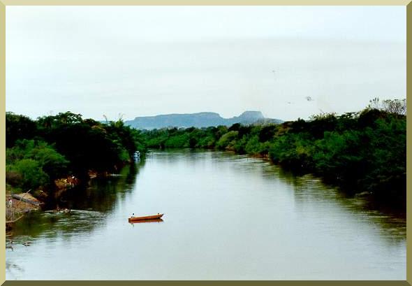
| The Miranda river, one of six principal tributaries of the Paraguay river, at Miranda, Mato Grosso do Sul. |