|
This last section summarizes the findings of this study.
It is divided into three subsections:
-
The Pantanal of Mato Grosso
-
The Hidrovia Project
-
The Hydrologic and Environmental Impacts.
Each subsection summarizes the main points established in this study. Additional
details can be found in the respective sections of this report: the Pantanal of Mato Grosso,
subsection 2.3 and Section 3; the Hidrovia Project, subsection 2.4; and Hydrologic and
Environmental Impacts, Section 4. A subsection entitled "Concluding Remarks" ends this
section of the report.
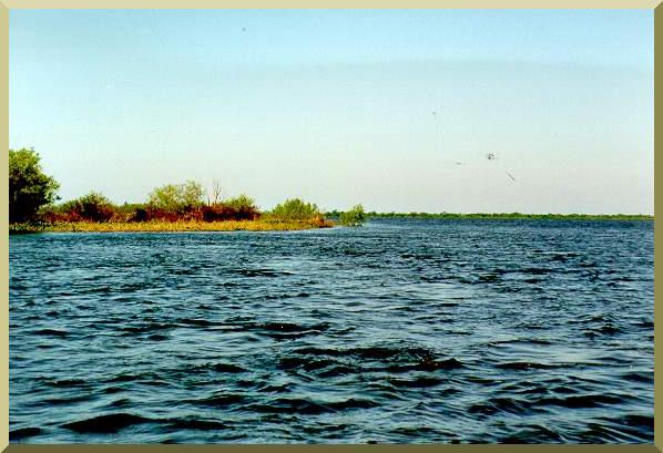
5.1 The Pantanal of Mato Grosso
The following points were established during the course of this study:
-
The Pantanal of Mato Grosso is a seasonally inundated depression wholly
contained within the Upper Paraguay river basin, encompassing 136 700
km2 in Mato Grosso and Mato Grosso do Sul, Central Western Brazil. The Pantanal
is an immense and biologically diverse wetland, geomorphologically and
hydrologically positioned to attenuate and reduce the runoff from the Upper Paraguay basin.
-
The predominantly Upper Precambrian formations underlie extensive
Quaternary deposits, with significant rock outcrops. Geomorphologic
evidence reveals the presence of a substantial amount of tectonic activity in the form of
subsidence and uplift.
-
The bed of the Upper Paraguay river is controlled by the prevailing geology.
The longitudinal profile of the river is convex when observed from above,
revealing the presence of substantial geologic controls. There are thirty-two
(32) documented rock outcrops within 1270 km of river, an average of one every 40 km.
-
The abnormally low runoff coefficient of the Upper Paraguay river at its
mouth (a value of 0.08) is a direct result of its hydrologic interaction with
the Pantanal. The latter functions as an immense surface/subsurface reservoir
which stores water in both annual and multiannual timeframes.
-
The Upper Paraguay river is very effective in decreasing the flood peaks
and correspondingly increasing the low flows. The presence of the Pantanal
provides the mechanism for the diffusion of flood flows and the increased
permanence of low flows.
-
The hydrographic records at Ladario show the extremely strong
attenuating capacity of the Pantanal upstream of this point. Throughout the entire
period of record (1900-95), the flood wave at Ladario has always been unimodal
(only one rise and one recession per year).
-
The Pantanal functions not only as an attenuating mechanism for flood
flows, but also as an abstracting mechanism for all flows, i.e., as an
effective means of storing the would-be runoff and converting it instead to
evaporation and evapotranspiration. Throughout millennia, this process has
been responsible for sustaining the extraordinary biotic potential of the Pantanal.
-
The Pantanal is still a surface of sediment accumulation, with a net annual
gain of sediment and nutrients.
-
The Pantanal is extremely rich in floristic diversity and physiognomic composition.
Its floristic diversity is due to its privileged location, surrounded by four
great South American biomes: the tropical Amazon rainforest, the subhumid
savannas of Central Brazil, the Atlantic humid forest, and the semiarid scrub forest of the
Chaco. Its diverse physiognomic composition is due to its variety of
geomorphic/topographic features.
-
The Pantanal remains a unique repository for a variety of wildlife species,
including numerous species of birds, fish, reptiles, and mammals. Many
species selectively inhabit the campos, vegetated earthmounds (capőes, cordilheiras),
gallery forests, and water courses (baías, corixos, vazantes) of the Pantanal. Such
impressive biodiversity is due in large measure to the unique geologic,
geomorphologic, and hydrologic setting of the Pantanal.
5.2 The Hidrovia Project
The following points were established during the course of this study:
-
The Paraná-Paraguay river system has been used as a waterway for transportation
for several centuries. The river system encompasses the Upper, Middle, and
Lower Paraguay rivers, and the Middle and Lower Parana rivers. It drains portions of
Brazil, Paraguay, Bolivia, and Argentina.
-
The Paraná-Paraguay Waterway Project, known locally as the Hidrovia
Paraná-Paraguay, for short, Hidrovia, is currently being considered for funding by
the Inter-American Development Bank.
-
The executive agency for the Hidrovia project is the Comité
Intergubernamental de la Hidrovía (CIH), an intergovernmental agency set up by the
governments of the five countries which have jurisdiction in the waterway: Argentina,
Bolivia, Brazil, Paraguay, and Uruguay.
-
The Hidrovia project entails navigational improvements along the existing
Paraná-Paraguay Waterway. The project considers extensive river engineering
works, including channel straightening, dredging, blasting of rocky sills, and other
structural interventions to render 3442 km of the river navigable for ocean-going
vessels, from the downstream point at Nueva Palmira, Uruguay, to the upstream point at
Cáceres, Mato Grosso, Brazil, near the headwaters of the Upper Paraguay river.
-
Since the port of Cáceres is located upstream of the Pantanal of Mato
Grosso, it is expected that the Hidrovia project, if implemented as
currently envisioned, will threaten the Pantanal's preeminent status as the
largest remaining wetland in the American continent and the world.
-
In February 1995, the Inter-American Development Bank and the United
Nations Development Programme commissioned engineering and
environmental impact studies of the proposed project. These studies are ongoing,
with results expected in late 1996.
-
To this date, the only comprehensive document on the Hidrovia project is
the INTERNAVE report, completed in 1990 by the Brazilian company Internave.
This report is essentially an economic feasibility study of the Hidrovia project.
-
The physical aspects of the proposed Hidrovia (channel straightening,
dredging, and blasting of rocky sills) are the source of significant concern among diverse
segments of the national and international communities, including indigenous
peoples, environmental organizations, nongovernmental organizations (NGOs),
professional associations, and universities in Brazil, the American continent, and the rest of
the world. The concern is that the Hidrovia project may cause irreparable harm to
the Pantanal wetlands, a significant focus of biodiversity in the American continent.
5.3 The Hydrologic and Environmental Impacts
The following points were established during the course of this study:
-
The proposed navigational improvements (channel straightening,
dredging, and blasting of rocky sills) will have a substantial impact on the flood
regime of the Upper Paraguay river. The degree of the impact will vary
depending on the type and extent of intervention, and its location along the river.
-
During high mean (2-yr), extraordinary (4-yr), and exceptional (10-yr)
floods, channel straightening will accelerate the concentration of flood
runoff and increase the flood wave peak at Ladario.
-
The Upper Paraguay river upstream of Porto São Francisco (located 146
km upstream of Corumbá) is incapable, without extensive artificial
channel deepening, of accomodating ocean-going vessels (with a 3-m draft
requirement) throughout the year. The planned extension of a 3-m navigation
channel all the way to Cáceres will require major interventions in the natural channel.
-
The Upper Paraguay river is subject to the "autodredging" phenomenon.
By adjusting the shape and configuration of its bedforms, the river is able, during low
flows to reduce its discharge while maintaining an approximately constant stage (and
minimum flow depth). In the Upper Paraguay river, this minimum depth is 1.2 m,
except where rock outcrops do not permit autodredging to take place. To the extent
that this minimum depth is violated in many places, it is concluded that the slope of
the Upper Paraguay river is geologically controlled.
-
Blasting rocky sills as a means of deepening the navigation channel will
have an irreversible impact on the hydrology of the Upper Paraguay river.
This is the most significant planned intervention. If pursued, it is likely to
change the Pantanal forever.
-
Navigation charts shows that the river has been able to carve a sufficiently
deep channel through most of the rock outcrops. Yet, in other places, where
the depth is shallower because rocky sills protrude into the channel, the river has not
yet carved an opening. The Pantanal exists because of these rocky sills, which
influence the regional flow patterns in Amolar, Porto da Manga, and Fecho dos Morros.
-
Backwater calculations confirm that relatively minor changes in grade,
which would necessarily take place as a result of blasting rocky sills, can
affect the upstream hydraulics to greater lengths than may have been
anticipated. The rocky sills act as natural dams; if they are removed, extensive areas
of the Pantanal will no longer be subject to seasonal flooding.
-
Removal of one rocky sill may lead to the appearance of another rocky sill
which was previously submerged. This is a distinct possibility in the Upper
Paraguay river, where rock outcrops have been documented to occur every 40 km on
the average, and where the prevailing channel slopes are so mild that the backwater
effect of a 0.5-m obstruction or hump may be felt for about 400 km upstream.
-
It is expected that channel modifications will destabilize the river's base
flow regime and will demand additional future interventions in the river to
continue to maintain the required minimum draft, i.e., it will set in place a
vicious circle of channel interventions.
-
The acceleration of runoff concentration caused by navigational channel
improvements will intensify high mean, extraordinary and exceptional floods,
potentially reduce the recurrence interval of drought periods, and may eventually lead to
regional climatic changes in the direction of greater aridity.
-
Extraordinary and exceptional flood peaks on the Upper Paraguay river
will be felt earlier downstream, at Asunción, on the Middle Paraguay, and
at Corrientes, on the Middle Paraná. The precise extent of this effect remains
to be determined by further analysis.
-
Changes in the runoff regime of the Upper Paraguay river are likely to
lead to substantial increases in mean albedo. In other parts of the world, the
evidence (circumstantial and experimental) is mounting linking increases in mean
albedo to climatic changes in the direction of greater aridity. The Pantanal is not
immune to climatic changes, which have occurred in the geologic past; the point to be
made is the rate of climatic change. It is now widely believed that anthropogenic
climatic change is possible and that it can occur in decades, rather than millennia.
-
The Pantanal exists because its climatic/geologic/geomorphologic setting
conditions it to retain water, sediment, and nutrients. Modifications in the
annual flood pulse will lead to changes in the Pantanal, both biotic and abiotic.
Increases in flood magnitude will result in increased sediment and nutrient losses.
-
The annual flooding of extensive areas of Pantanal serves the dual
purpose of effectively controlling overgrazing and replenishing the soil with
fresh nutrients. More importantly, the seasonal flood pulse is instrumental in
maintaining the grasslands, since competing vegetation types, particularly the woody
species, are not well adapted to the extreme alternations of saturation and desiccation.
-
Changes in hydrologic regime resulting in increased floods and droughts
will impair nutrient replenishment and lead to reductions in biotic
productivity. These changes will produce a succession from herbaceous to woody species,
which will change the dominant character of the Pantanal from savanna woodlands
to more mesic forests. The open grasslands will shrink, and this will have a negative
impact on cattle ranching.
5.4 Concluding Remarks
The Hidrovia project is expected to have a significant hydrologic and environmental
impact on the Upper Paraguay river and the adjoining Pantanal of Mato Grosso. The
latter is a unique terrestrial region where an unusual combination of continental location,
climate, geology, geomorphology, and surface and groundwater hydrology has
contributed, through millennia, to the establishment of a delicate ecological balance.
Throughout the past two centuries of human settlement, the environmental impact of cattle
ranching, considered to be the most important economic activity in the Pantanal,
appears to have been minimal.
In essence, the Hidrovia project seeks to convert a portion of the water
resources, from the maintenance of an environment suited to low-density
cattle ranching and diverse wildlife habitats, to the maintenance of an inland
waterway for the transportation of goods, primarily for export. For this
purpose, the project proposes to carve a channel, sufficiently straight and deep to be suited
for ocean-going vessels, all the way to Cáceres, upstream of the Pantanal.
The Upper Paraguay river, from its mouth at the Apa river confluence to the city of
Corumbá (a distance of 590 km upstream), is generally straight and deep enough for the
passage of large vessels, excluding a few locations where some dredging may be required
if the navigation project is implemented up to Corumbá. However, upstream of
Corumbá, toward Cáceres (a distance of 680 km), the river is too shallow and in some
places too sinuous to effectively function as a commercial year-round waterway.
This is why current commercial river traffic between Corumbá and Cáceres is almost nonexistent. The artificial straightening and deepening of the Upper Paraguay river
all the way to Cáceres will provide a navigation channel, but at the cost of
substantial losses of water, sediment, and nutrients.
How these losses will compare with the project gains (expected reductions
in transportation costs) is a question that deserves a clear and definitive
answer prior to project implementation. This is particularly crucial in the case of the
Pantanal, where irreversible interventions in the natural channel (the blasting of rocky
sills) have the potential to destabilize the hydrologic regime. The Pantanal ecosystems
are extremely complex, and their myriad of biotic/abiotic interrelations are only now
being thoroughly examined (Prado et al, 1994; Heckman, 1994; and others). Unless all
costs are effectively incorporated into the economic analysis, the prudent course of
action is to preserve the Pantanal's preeminent status as the largest and most biologically
diverse wetland of the Americas and the world.
|