|
|

| 2. MANAGEMENT OF SAND MINING |
|
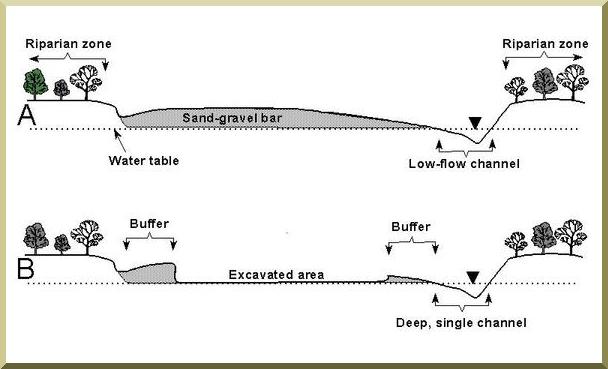
Figure 3 shows the mining of a sand-gravel bar in which the excavated area is limited to depths above the water table and buffer zones protect the
deep single channel and channel banks. |
|
| Fig. 3 Diagram of channel cross sections showing (A) a typical sand-gravel bar in relation to the low-flow channel, riparian zone and water table, and (B) the protected deep, single channel and channel banks when mining is restricted within a buffer of designated width and above the watertable. |
|
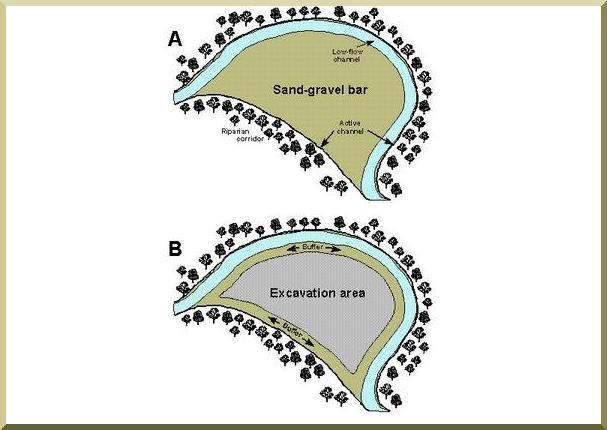
Two minimum-width buffers should separate the excavation area (extraction site) from the low-flow channel and the adjacent channel bank (Fig. 4).
These buffers lessen the risk of mining-induced headcuts; however, "hungry" water can still lead to channel
incision downstream.
Bar skimming can also cause other problems such as elimination of side channels, abrupt relocation of the low-flow channel, and higher
mobility of loosened sediments. Gravel-rich streams are less susceptible than gravel-poor streams to disturbance from bar skimming.
This is because replenishment by excess gravel from upstream sources would partially mitigate channel disruption.
Mining of bars in gravel-rich streams should be preferred over mining in gravel-poor streams.
Reaches that receive high rates of deposits may be better locations for mining than reaches that do not.
|
|
| Fig. 4 Diagram of typical sand gravel bar showing (A) the relative positions of the bar, the riparian corridor, the active (or bankfull) channel and the lowflow channel, and (B) the area of excavation defined by a no-disturbance buffer of designated width. |
|
The following criteria are recommended in the literature:
|
|
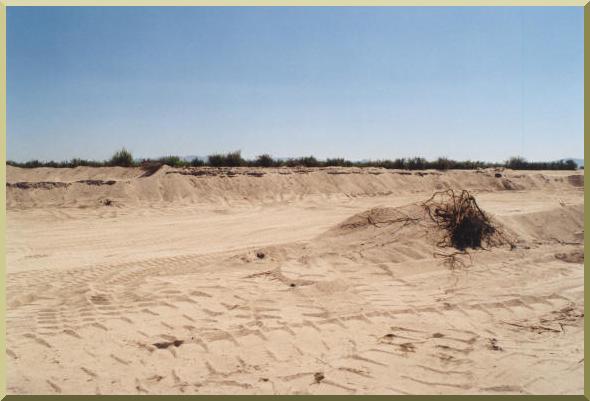
| Fig. 5 Sand Mining in El Barbon Wash near Real del Castillo (July 2001) |
| Impacts of Sand Mining | Regulation of the Sand Mining in the U.S. | Strategies for the Ojos Negros Valley | Summary | Sand Mining Facts |
| http://ponce.sdsu.edu/three_issues_sandminingfacts02.html | 021104 |