-
Feasibility of pumping scheme to provide water for Tecate River Park, Web published, October 2004.
|
Abstract:
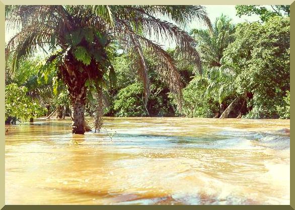
The feasibility of pumping treated effluent to provide water for the Tecate River Park is reported here.
The Tecate river is an ephemeral stream (arroyo or wash) and, therefore, it carries water only during heavy rains and associated floods.
The 10-yr flood has been estimated at 79 m3/s (79,000 L/s).
A certain amount of recycled water, estimated between 40 and up to 300 L/s, may be available to benefit the Tecate River Park.
The fate of this water, once delivered to the Tecate River Park, is assessed herein.
The hydraulic conductivity of the bed material in the Tecate river has been measured in-situ at six (6) sites along the study reach,
labeled in the downstream direction, from RP-1 to RP-6.
The bed material consists of poorly graded sands (SP) and fine sands with silt (SP-SM), with some exceptions.
Tests show that the hydraulic conductivity varies from high to very high.
Channel routing shows that if
the hydraulic conductivity of the streambed is very high, the delivered flows will be abstracted very quickly into the groundwater and very little of it will remain
in the surface waters.
On the other hand, if the hydraulic conductivity is high, a substantial fraction of the delivered flows
will remain in the surface water and in the vadose zone, and become available for evapotranspiration.
The RP-1 and RP-6
locations showed very high (higher) values of hydraulic conductivity, while
the RP-2 and RP-4 locations showed high (i.e., lower) values.
A suitable alternative may be a narrow (2-m wide) pilot channel,
constructed exclusively for the purpose of optimizing the permanence of surface water. This pilot channel may serve the objective of keeping the delivered
water on the surface, to more directly benefit the river park and its associated vegetation.
The surface water will directly benefit the river park by enhancing landscaping and aesthetics.
The subsurface water (vadose-zone water and groundwater) will benefit the river park through riparian vegetation.
The replenishment of groundwater will directly benefit the local aquifer.
|
-
Dam-breach flood wave propagation using dimensionless parameters, Journal of Hydraulic Engineering,
Vol. 129, No. 10, October, 2003, 777-782.
|
Abstract:
An analytical model of flood wave propagation is used to study the sensitivity of dam-breach flood waves to breach-outflow hydrograph volume, peak discharge,
and downstream-channel bed slope. Dimensionless parameters are identified for discharge and distance along the channel. A dam-breach Froude number is
defined to enable analysis through a wide range of site and flow conditions. It is found that, at a certain distance downstream, the attenuated peak discharge
is independent of the megnitude of the discharge at the breach site. This attenuated peak discharge is termed the "ultimate discharge," and the distance
associated with it, the "ultimate distance." These ultimate values are a function, primarily of the bed slope and, secondarily, of the breach-outflow hydrograph
volume.
|
-
Embankment dam breaching: Geometry and peak outflow characteristics, Dam Engineering,
Vol. XIV, Issue 2, 2003, 73-87.
|
Abstract:
A review of dam breach parameters and prediction methods developed from the analysis of historic embankment dam failures is performed.
A new shape factor representing dam breach geometry is formulated. A relationship between the Froude number, based on peak discharge, and the new shape factor is identified.
|
-
Drought characterization in the Ojos Negros region, Baja California, Mexico, Revista de Estudos Ambientais, Vol. 4, No. 1, January-April, 2003.
|
Abstract:
Drought phenomena in the Ojos Negros region, in Baja California, Mexico,
has been analyzed using the conceptual model developed by Ponce et al. (2000).
Climatological data for ten stations encompassed within the study region were used
in the analysis.
Drought intensity, duration and frequency extracted from the data were compared with
model predictions.
Event drought intensity varied from 0.61 to 1.23, with an average of 0.83.
Drought duration varied from 2 to 3 yr, with an average of 2.46 yr.
Drought frequency varied from 3.5 to 4.83 yr, with an average of 3.96 yr.
Drought intensity vs exceedence probability has also been determined.
|
-
Sustainable management of water in the Ojos Negros valley, Baja California, Mexico, Web published, July 2002.
|
Abstract:
The Ojos Negros valley, in Baja California, has been studied from an interdisciplinary perspective,
with the principal focus on the relationship between irrigated agriculture and groundwater use,
including the environmental and social impacts thereof.
In the past 130 years of recorded history,
the valley has undergone a significant social and economic transformation, such that it now
represents a substantial entity among the agricultural regions of the state. This change has been positive from
an economic and social standpoint; however, the ecological and environmental impacts have been negative.
Irrigated agriculture has resulted in an increase of actual evapotranspiration, as large amounts of subsurface water
became part of the surface-water system. Apparently, this has led to a humidification of the local
climate, as assessed by a marked decrease
(9 oC) in the temperature range during the period of record. The effect is
anthropogenic; therefore, it is expected to continue as long as irrigation continues.
In the past 30 years, the increased pumping of groundwater has resulted in a depletion of the water table,
which now lies at more than 30-m depth in certain places. The lowering of the water table has negatively
affected wetland and riparian ecosystems, which prior to the advent of pumping were quite extensive,
and now have been reduced to a fraction of their former size. In particular, the drying out
of the Ojos Negros marshes, which gave its name to the valley, is attributed to the depletion of groundwater.
Average water table depletion was forecasted to be 0.4 m yr-1
for the 50-yr planning horizon,
assuming present pumping rates (year 2000).
This rate of depletion has an effect on the profits of agricultural operations,
but the effect does not appear to be substantial, if not for the ejido proprietors, certainly
for the agroindustrial companies that operate in
the valley.
The apparent lack of
sensitivity is attributed to the low cost of energy, since the electric tariffs
for agricultural groundwater pumping are the lowest.
In the absence of appropriate regulation, it is likely that
most stakeholders, including ejido proprietors and agroindustrial companies,
will continue to operate their agricultural enterprises into the future.
It is certain that the groundwater depletion at Ojos Negros is related to the classical
"Tragedy of the Commons."
According to this principle, resources held in common will tend to be overexploited by
individuals seeking their own gain.
Viewed in this light, aquifer regulation appears to be the only way out of this predicament.
Regulation should go hand-in-hand with monitoring, since sound policy should always be
based on sound data. With regulation, there is an increased chance that the resource
will still be there
for the benefit of future generations.
|
-
Flood hydrology of the Binational Cottonwood Creek - Arroyo Alamar,
California and Baja California, Web published, July 2001.
|
Abstract:
The flood hydrology of the Binational Cottonwood Creek - Arroyo Alamar, located in California
and Baja California, has been studied.
The majority of the contributing watershed (86.2 percent) is located in San Diego County,
and the remaning portion (13.8 percent) lies within the municipalities of Tijuana and Tecate, in Baja
California.
The objective is the calculation of flood flows for return periods from 2 to 1000 years.
The analysis has been made using a conceptual hydrologic modeling of rainfall-runoff, of general
aplicability. The principal characteristics of the model are:
(1) generalized topology, capable of handling a drainage network of any order;
(2) rainfall specified for each subbasin, either upland or reach;
(3) hydrologic abstraction with the SCS runoff curve number;
(4) conversion of rainfall to runoff by means of the convolution of the effective hyetograph with the SCS unit hydrograph;
(5) reservoir routing with the storage indication method;
(6) channel routing with the Muskingum-Cunge method; and
(7) calculation of channel transmission losses for flood propagation in ephemeral streams.
The model was run to determine flood discharges for return periods from 2 to 1000 years,
specifying the maximum of the mean monthly levels for the period of record
as initial condition in Morena and Barrett dams, which control
the flow of Cottonwood Creek, in San Diego County.
The flood discharges calculated for return periods of 2, 5, 10, 25, 50, 100, 200, 500, and 1000 years
are: 280, 530, 680, 930, 1140, 1310, 1420, 1600, and 1720 m3 s-1,
respectively.
For the delimiting of federal zones, the design discharge should be greater than 680
m3 s-1, corresponding to a 10-yr return period.
For the design of the channel improvements, assuming the applicability of agricultural zones with urban settlements,
the design discharge should be greater than 1140 m3 s-1,
corresponding to a 50-yr return period, and less than or equal to 1420 m3 s-1,
corresponding to a 200-yr return period.
|
-
Modeling looped ratings in Muskingum-Cunge routing, Journal of Hydraulic
Engineering, April 2001.
|
Abstract: The Muskingum-Cunge flood routing model is extended to the realm of looped ratings.
This is accomplished by reformulating the conventional four-point model to use the local
water surface slope and the Vedernikov number in the expression for hydraulic diffusivity.
The developed model was successful in generating looped ratings under a wide range of kinematic/diffusive
unsteady flow conditions. Numerical experiments were used to test the looped-rating Muskingum-Cunge model.
Resolution level, flood wave period, baseflow, and peak-inflow/baseflow ratio were varied to determine
loop thickness and percentage mass conservation. Comparison of the looped-rating Muskingum-Cunge with a
dynamic wave model (a complete solution of the St. Venant equations) showed that both models are capable
of generating looped ratings and outflow hydrographs of comparable accuracy.
|
-
Potential climatic change derived from the exploitation of groundwater in the Ojos Negros
valley, Baja California,
Geographical Investigations UNAM , 44, 2001.
|
Abstract:
A detailed analysis of the records of climatological variables for the Ojos Negros valley, Baja
California, revealed a negative tendency for temperature and positive tendency for
precipitation, along the study period (1949-93). The increasing groundwater extraction for
agricultural use produces a change in the energy balance and a decrease in albedo. From these data, it is
inferred that a change in evapotranspiration and a humidification of the local climate occur, hence
affecting the analyzed climatological variables. A similar, although more moderate trend, was observed
in two climatological stations located nearby which were used as control.
|
-
Restoration of the Salton sea using solar still distillation,
Review of Environmental Studies, May 2000.
|
Abstract:
The Salton Sea is the largest lake in California,
encompassing 979 km2 (378 mi2) in Imperial and Riverside counties,
in the southeastern portion of the state.
The lake is used as a repository for agricultural wastewater
from the neighboring Imperial and Coachella valleys.
The wastewater has a high concentration of dissolved solids, up to 3.6 ppt.
The lake is threatened by rising salinity, which currently exceeds 44 ppt.
The restoration proposal uses solar still distillation to separate
the salts from the water.
The distilled water is either returned directly to the lake
or commercialized to control the lake level.
The salts can be exported for ultimate disposal in the high seas.
|
-
Characterization of drought across the climatic spectrum, Journal of Hydrologic
Engineering, April 2000.
|
Abstract: A conceptual model of drought characterization across the climatic spectrum is formulated.
The model is particularly suited to subtropical and midlatitudinal regions.
Drought duration, intensity, and recurrence interval are
expressed in terms of the ratio of mean annual precipitation
to annual global terrestrial precipitation.
The model is useful as a framework for the systematic analysis of droughts
and the assessment of changes in drought characteristics due to climatic changes.
|
-
Hydrologic and environmental impact of the Parana-Paraguay waterway
on the Pantanal of Mato Grosso, Brazil,
San Diego State University, August 1995.
|
EXECUTIVE SUMMARY
The hydrologic and environmental impacts that the proposed Hidrovia navigation
project would have on the Pantanal of Mato Grosso are evaluated in this report.
The Pantanal is a seasonally inundated depression, characteristically a wetland
(or closely related group of wetlands), wholly contained within the Upper Paraguay
river basin. It encompasses an area of 136 700 km2
in the states of Mato Grosso and Mato Grosso do Sul, in Central
Western Brazil. The Hidrovia project entails navigational improvements along the
existing Paraná-Paraguay Waterway, which links five countries of
South America: Argentina,
Bolivia, Brazil, Paraguay, and Uruguay. The project considers extensive river engineering
works, including channel straightening, dredging, blasting of rocky sills,
and other structural interventions to render 3442 km of the river
navigable for ocean-going vessels.
The affected region would be from the downstream point at Nueva Palmira, Uruguay, to
the upstream point at Cáceres, Brazil, near the headwaters of the Upper Paraguay river.
At issue is the impact that extensive channel modifications will have on the
Pantanal, the largest remaining wetland in the world.
The proposed navigational improvements are likely to have a substantial impact on
the flood regime of the Upper Paraguay river. The degree of the impact will vary
depending on the type and extent of intervention and location along the river.
In particular, channel straightening upstream of Corumbá will
accelerate the concentration of flood runoff and increase the
flood wave peak at Ladario, a key reference point in the Pantanal,
during high mean (2-yr), extraordinary (4-yr), and exceptional (10-yr) floods.
The Upper Paraguay river upstream of Porto São Francisco (located 146 km upstream
of Corumbá) is incapable, without extensive artificial channel deepening,
of accomodating ocean-going vessels (requiring a 3-m draft)
throughout the year. Currently, autodredging,
the river's natural self-cleaning/deepening process, provides a minimum depth of 1.2 m,
except where rock outcrops do not permit autodredging to take place.
The longitudinal profile of the Upper Paraguay river is convex when observed from
above, revealing the presence of substantial geologic controls. These controls operate in
the form of rock outcrops on the banks or rocky sills in the middle of the channel. The
Pantanal exists largely because of these geologic controls, which influence the regional
flow patterns in at least three places: Amolar, Porto da Manga and Fecho dos Morros.
The rocky sills act as natural dams; if they are removed, extensive areas of Pantanal will
no longer be subject to seasonal flooding. Blasting rocky sills as a means of deepening
the navigation channel will have an irreversible impact on the hydrology of the Upper
Paraguay river. Furthermore, the removal of one rocky sill may lead to the appearance
of another rocky sill which was previously submerged. This is a distinct possibility in the
Upper Paraguay river, where rock outcrops have been documented to occur every 40
km on the average, and where the prevailing channel slopes are so mild (around 1-2
cm/km) that the backwater effect of a 0.5-m flow obstruction can be felt for about 400
km upstream.
The acceleration of runoff concentration caused by navigational improvements will
intensify most annual floods, may reduce the recurrence interval of multiannual droughts,
and may eventually lead to regional climatic changes in the direction of greater aridity.
The Pantanal exists because its climatic/geologic/geomorphologic setting conditions it to
retain water, sediment, and nutrients. Increases in flood magnitude will result in increased
losses of sediment and nutrients.
The annual flooding of extensive areas of Pantanal serves the dual purpose of
effectively controlling overgrazing while replenishing the soil with nutrients.
In addition, the
seasonal flood pulse is instrumental in maintaining the extensive grasslands, since
competing vegetation types, particularly the woody species, are not well adapted to extreme
alternations of saturation and desiccation.
Changes in hydrologic regime resulting in increased intensity of floods and droughts
will impair nutrient replenishment in the Pantanal and lead to decreases in biotic
productivity. These changes will produce a succession from herbaceous to woody species, which
will eventually change the dominant character of the Pantanal, from savanna woodlands
to more mesic forests. The open grasslands will shrink, and the cattle raising industry
will be negatively impacted.
|
|